Welcome to NEFF

Sign up for a new account today, or log on with your old account!

Give us a try!

Welcome back to the new NEFF. Take a break from Twitter and Facebook. You don't go to Dicks for your fly fishing gear, you go to your local fly fishing store. Enjoy!

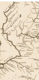
Old New Jersey river map.

I have a map from the same time period that shows the terrain, roads, and towns. One difference is that it refers to the "Flat Kill". It is a large map and my wife wonders why I stand in the hallway not moving as I search across the entire State. As a brook trout fan there would have been many places to fish in North and North-Central NJ, although getting there would be a problem.
 
I love this. There is a tidal creek southwest called Mooresfield creek(now Pennsauken creek) that flows through Moorestown, where I live. It was named for Moores Tavern which was in the area during colonial times. Ancocas creek just to the north is now Rancocas creek. There is a tiny little crrek around here which will remain unnamed that still has some brook trout in it.
 
The river we now know as the Musconetcong has had many spellings. The problem was that the native Americans did not have a written language, so early European settlers wrote down that word in their own languages (Scotch/German/English/Irish) and it got bastardized by that. It means a river flowing from two lakes which were under what is today Lake Hopatcong.
 
Back
Top