Welcome to NEFF

Sign up for a new account today, or log on with your old account!

Give us a try!

Welcome back to the new NEFF. Take a break from Twitter and Facebook. You don't go to Dicks for your fly fishing gear, you go to your local fly fishing store. Enjoy!

Musky Help

Oliver10

Profishional Cupcake
I am going to a family event in Long Valley tomorrow right on the border with Hackettstown. I am "allowed" 3 hours to sneak out and fish the Musky. I don't know where to go up there. The last time I was in the this situation I hit Saxon's falls in June and only caught sunnies. I don't want to fish Saxons falls or Stephans State park. I can probably take 4 hours and apologize. It will be in the afternoon. I also have my 10Wt I may go and make hero casts at Tilcon lake for fun if nobody comes up with a better suggestion.

I fished the KLG this morning from 6-9. I got a 12 inch rainbow nice fins. No pictures. I will not be going back there anytime soon. I hate hate hate wading there. Too slippery for me. I did not fall in this time but there were a few hairy moments and not many people around. I much happier fishing the upper SBR gravel bottom more fish for me and never see anybody.
 
Point Mountain TCA is close and has great fishing. There's tons of public water on the Musky, but that is a no-brainer. Park either at Point Mountain Road and walk upstream on the Hunterdon side or park up top near the Penwell bridge. Off Penwell Road you'll see a narrow opening in the guardrail. Drive in there. It's Faber Road, but there are no signs and it dead ends against the river on the upper TCA. You'll see the remnants of an old stone house. Fish up and downstream of there. Wading is easier than Ken Lockwood Gorge, but not a ton easier in high flows.
 
I will not be going back there anytime soon. I hate hate hate wading there. Too slippery for me. I did not fall in this time but there were a few hairy moments and not many people around. I much happier fishing the upper SBR gravel bottom more fish for me and never see anybody.

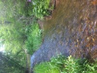
Pussy!!!!

:)
 
Point Mountain TCA is close and has great fishing. There's tons of public water on the Musky, but that is a no-brainer. Park either at Point Mountain Road and walk upstream on the Hunterdon side or park up top near the Penwell bridge. Off Penwell Road you'll see a narrow opening in the guardrail. Drive in there. It's Faber Road, but there are no signs and it dead ends against the river on the upper TCA. You'll see the remnants of an old stone house. Fish up and downstream of there. Wading is easier than Ken Lockwood Gorge, but not a ton easier in high flows.

Thanks

I have fished point mountain a few times. I don't get the hype. I will just look at my big apple book and look at a map. Maybe some general regs pequest water
 
Thanks

I have fished point mountain a few times. I don't get the hype. I will just look at my big apple book and look at a map. Maybe some general regs pequest water

I barely know these waters compared to most guys on this board -- but I've found the Pequest to be very frustrating. There are lots of bugs and the fish don't seem to give a shit about them.
 
Just over the hill in downtown long Valley is the upper SBR. Turn right at the light and park in the lot next to the bike shop or go 1 mile down to a large gravel pull off. Explore when you get there. Hatches haven't started in full, but you can get a pick of wild fish on top.

Muskie. Head down Rte 57 and stop about anywhere. By a big gray restaurant with a for sale sign has been good. If you go to PT Mountain I would go to the lower end. I was at the upper end last night and it was a touch high for risers since it has a higher gradient, I suggest the slower pools at the lower end. The hatches have been better at the Muskie, but they have been compressed to just at dark. It has been a good level for streamers if you are in the mood for that. Also, it is almost entirely little stocked rainbows.

Haven't hit the Pequest this week. Pequest has late hatches and the water is just a little higher than I like for dries. If it is on, it will be an evening event.
We've been getting a little rain each day for a week. The larger streams are a touch high.
 
I am very familiar with the upper SBR. Most of my favorite places to fish are up stream of Long Valley. Based on what you said about things being a little high and also my free time is going to be mid afternoon I might just fish a WTS trib of the Musky. I am not going to post publicly about the one I am going to try. Thin blue line time. I will probably take a look at Tilcon too.
 
Fished a tiny stream. Got 3 little brookies missed some more. 3 hours in absolute solitude. Jeff K knows the stream I fished. It might rhymes with Prances or maybe it rhymes with Pout or maybe Tear. It was a brook though. Find in public access was hard to say the least. No pictures of fish photo.jpg
 
Visited Millbrook Village w/my wife & with the dog, hiked up along Van Campens w/my 2wt. The Lab kept crashing into whatever little pool or run I found, so I hardly fished. But I did lose (regardless of what Walton wrote) a 5 inch trout with some red on it, so it might have been a brookie, rather than a brown with more subdued red. Beautiful little stream. The Pequest was high & off color. Paulinskill was in better shape & I didn't get a good look at the Musky. My upper back killed me so badly that while fishing the first run, I was about to quit, but I said to hell with that and managed to straighten my back some. I told my wife that when I was 17, I fished the Dunnfield from the parking lot to its source on the ridgetop plateau in one day. Man, those were the days. I bushwhacked through dense thickets...there was no trail at all up there. Nevertheless, I mean to fish some of these little streams.
 
Should have taken the road up Dunnfield Hollow. Up until the Depression when old man Worthington bought up most of the area there were farms and houses all the way up Dunnfield Hollow. There was a mill where the stream flattens out at the top of the gorge where two roads crossed. In the 60's and 70's could see the foundations of the millers house pretty well and his yard was an open spot for a long time. Over the years it has all been falling apart and hurricane Otto sure washed out a lot of it. In the early 70s the stocking truck still made it up almost to the old mill site (the truck used to turn around where the creek makes an S bend and the two fords/bridges are) , but a few spots have completely washed out over the years.

The way I used to drive to Hainey's Mill on the Flat Brook when I was 17 was from Millbrook on Donkey Corners Rd. It is amazing that past the road to Blue Mountain Lake it is almost hard to find now.
 
Interesting history. North Jersey was largely cleared for farmland, 19th century, from what I've heard. Dunnfield gives you the impression now that it's always been wild. Think I recall the S curve, I know the brook did some sharp twisting somewhere. I used to hike the AT road up the hollow, but it diverges and goes on up to Sunfish Pond, where that falls and deep plunge pool resonates aqua-marine green. One summer, 90 degrees, I dove in head first. I was shocked to the bone. So much is said about making sure not to fish trout in water warmer than 68 degrees, but this water was somewhere in the 50's, certainly no warmer. I never noticed any foundations or mill site. I stuck to streamside that whole hike up when I was 17. Road to Blue Mountain Lake ends at Crater Lake, doesn't it? Not familiar with Donkey Corners. Hurricane Irene wiped out the road along Flatbrook at the twin bridges. Wonder if that's fixed.
 
Interesting history. North Jersey was largely cleared for farmland, 19th century, from what I've heard. Dunnfield gives you the impression now that it's always been wild. Think I recall the S curve, I know the brook did some sharp twisting somewhere. I used to hike the AT road up the hollow, but it diverges and goes on up to Sunfish Pond, where that falls and deep plunge pool resonates aqua-marine green. One summer, 90 degrees, I dove in head first. I was shocked to the bone. So much is said about making sure not to fish trout in water warmer than 68 degrees, but this water was somewhere in the 50's, certainly no warmer. I never noticed any foundations or mill site. I stuck to streamside that whole hike up when I was 17. Road to Blue Mountain Lake ends at Crater Lake, doesn't it? Not familiar with Donkey Corners. Hurricane Irene wiped out the road along Flatbrook at the twin bridges. Wonder if that's fixed.

Every stitch of land you see in NJ save 4 sites totaling 330 acres has been logged at one time or another.
 
Interesting history. North Jersey was largely cleared for farmland, 19th century, from what I've heard.

Farmland or clear cut for burning fuel for the iron furnaces, I've been told the ridge and valley from west milford to Ringwood was mostly evergreens at one point


Sent from my iPhone using Tapatalk
 
Back
Top