skipper3245
Barbless Hooks save lives
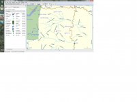
So I purchased a Garmin oregon 450T about a year ago, and its been amazing for me since it comes with US topo maps and 3d imaging. It is very very easy to find places to fish that almost nobody has ever been to. I will be in Chile/Argentina for the next 3 months, and was curious about how garmin did with South America mapping. It is just a birds eye veiw so it is pretty bad. Garmin does not have any packages for SA and no other commercial company does either. This site http://www.proyectomapear.com.ar/eng_tutorial/index.htm Saved my life pretty much. The entire process is in spanish, but it is very clear with the english text bubbles on the side. You need the program mapsource to use the files and it says to download version 5, but now its version 9.2 and just look for the word argentina and download that one. I transferred it over to my gps and it is extremely detailed. No topo, but the best mapping that I have seen out there for SA. To switch in to this map on ur garmin, just go to setup-map-and enable your new map.
What I found most useful is that you can use mapsource to zoom in and mark all your waypoints of interest on ur computer so you do not have to look around on ur gps. Then you can transfer all of that info to ur gps. Hope this helps someone in the future so they dont waste a week like I did.
Skip
What I found most useful is that you can use mapsource to zoom in and mark all your waypoints of interest on ur computer so you do not have to look around on ur gps. Then you can transfer all of that info to ur gps. Hope this helps someone in the future so they dont waste a week like I did.
Skip